1-20
of
33,502
results
-
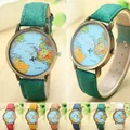
Hot Sale Mini World Fashion Qu...Hot Sale Mini World Fashion Quartz Watch Men Unisex Map Airplane Travel Around... Hot Sale Mini World Fashion Quartz Watch Men Unisex Map Airplane Travel Around The World Women more
-
16Pcs English Decoration Drawi...16Pcs English Decoration Drawing Wall Map Early Enlighten Poster Alphabet Char... 16Pcs English Decoration Drawing Wall Map Early Enlighten Poster Alphabet Chart Talking Educational more
-
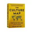
The Culture Map by Erin Meyer ...The Culture Map by Erin Meyer Decoding How People Think Lead And Get Things Do... The Culture Map by Erin Meyer Decoding How People Think Lead And Get Things Done Paperback Book in more
-
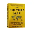
The Culture Map by Erin Meyer ...The Culture Map by Erin Meyer Decoding How People Think Lead And Get Things Do... The Culture Map by Erin Meyer Decoding How People Think Lead And Get Things Done Paperback Book in more
-
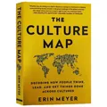
The Culture Map by Erin Meyer ...The Culture Map by Erin Meyer Decoding How People Think Lead And Get Things Do... The Culture Map by Erin Meyer Decoding How People Think Lead And Get Things Done Paperback Book in more
-
The Culture Map by Erin Meyer ...The Culture Map by Erin Meyer Decoding How People Think Lead And Get Things Do... The Culture Map by Erin Meyer Decoding How People Think Lead And Get Things Done Paperback Book in more
-
Use Mind Map To Learn 3500 Eng...Use Mind Map To Learn 3500 English Words In 10 Days Memorize The Word Artifact... Use Mind Map To Learn 3500 English Words In 10 Days Memorize The Word Artifact Root Dictionary and more
-
New Hot Travelogue Scratch Wor...New Hot Travelogue Scratch World Map Travel Tips Book Journal Log Notebook Tou... New Hot Travelogue Scratch World Map Travel Tips Book Journal Log Notebook Tourist Gift more
-
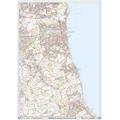
North Wales and Anglesey Postc...Size: 73 x 107 cm (29 x 42 inches). Scale: 1:150 000 (2.4 miles to 1 inch). Ge... Size: 73 x 107 cm (29 x 42 inches). Scale: 1:150 000 (2.4 miles to 1 inch). Geographical Coverage Guide - North: Liverpool South: Church Stoke East: Chester West: Bardsey Island The map shows the first part of the Postcode and the first number of the... more
-
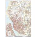
North Cumbria Postcode Sector ...Size: 73 x 107 cm (29 x 42 inches). Scale: 1:150 000 (2.4 miles to 1 inch). Ge... Size: 73 x 107 cm (29 x 42 inches). Scale: 1:150 000 (2.4 miles to 1 inch). Geographical Coverage Guide - North: Kirkstile South: Kendal East: Stocksfield West: Dalbeattie The map shows the first part of the Postcode and the first number of the second... more
-
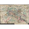
1861 map Map of the First Batt...Description: 1861 map Map of the First Battle of Bull Run Shows the movement o... Description: 1861 map Map of the First Battle of Bull Run Shows the movement of the Union and Confederate forces as their positions changed over the course of July 21, 1861, during the First Battle of Bull Run. Sneden illustrates the battle over the... more
-
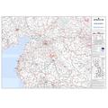
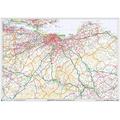
Humberside and N E Midlands (L...Size: 73 x 107 cm (29 x 42 inches). Scale: 1:150 000 (2.4 miles to 1 inch). Ge... Size: 73 x 107 cm (29 x 42 inches). Scale: 1:150 000 (2.4 miles to 1 inch). Geographical Coverage Guide North: Market Weighton South: Sleaford East: Skegness West: Sheffield The map shows the first part of the Postcode and the first number of the... more
-
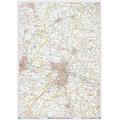
50 Miles around Birmingham Roa...49.25 x 34.5 inches. Laminated. Flat map, tubed for shipping. A-Z Road Map of ... 49.25 x 34.5 inches. Laminated. Flat map, tubed for shipping. A-Z Road Map of Birmingham covers and area extending to: Chester, Congleton, Bakewell, Mansfield, Newark-on-Trent, Corby, Northampton, Milton Keynes, Aylesbury, Oxford, Cirencester,... more
-
Sunderland - SR - Postcode Wal...A High Quality Postcode Sector Wall Map. Showing the Entire SR Postcode Area, ... A High Quality Postcode Sector Wall Map. Showing the Entire SR Postcode Area, with Precise Boundaries and Clear Postcode Labels on a Detailed Map Background. A0 Size - 1189mm x 841mm Plastic Coated waterproof / wipeable more
-
Liverpool - L - Postcode Wall ...A High Quality Postcode Sector Wall Map. Showing the Entire L Postcode Area, w... A High Quality Postcode Sector Wall Map. Showing the Entire L Postcode Area, with Precise Boundaries and Clear Postcode Labels on a Detailed Map Background. A0 Size - 1189mm x 841mm Plastic Coated waterproof / wipeable more
-
Edinburgh - EH - Postcode Wall...A High Quality Postcode Sector Wall Map. Showing the Entire EH Postcode Area, ... A High Quality Postcode Sector Wall Map. Showing the Entire EH Postcode Area, with Precise Boundaries and Clear Postcode Labels on a Detailed Map Background. A0 Size - 1189mm x 841mm Plastic Coated waterproof / wipeable more
-
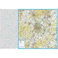
Large Southeast England & Midl...This map covers the following area - North = Nottingham, South = Isle of Wight... This map covers the following area - North = Nottingham, South = Isle of Wight, East = Broadstairs, West = Hereford and has detailed inserts for the cities of Birmingham, Bristol and London City Centre This large wall map measures 91 x 127 cm (35 x 50... more
-
Telford - TF - Postcode Wall M...A High Quality Postcode Sector Wall Map. Showing the Entire TF Postcode Area, ... A High Quality Postcode Sector Wall Map. Showing the Entire TF Postcode Area, with Precise Boundaries and Clear Postcode Labels on a Detailed Map Background. A0 Size - 1189mm x 841mm Plastic Coated waterproof / wipeable more


Ads related to gestalten a map of the